Locations
Company type
Result types
Industries
Employees
Founding year

The B2B platform for the best purchasing descision. Identify and compare relevant B2B manufacturers, suppliers and retailers
Close
Filter
Result configuration
Continents
Select continent
Locations
Result types
Company type
Select company type
Industries
Select industry
Company status
Select company status preset
Number of employees
Min.
Max.
Founding year
AMI Systems
Gdynia, Poland
B
1-10 Employees
2020
Key takeaway
The company, AMI Systems, emphasizes the advantages of their high-quality UAV LiDAR technology for land surveying, particularly in densely vegetated areas and forests, providing accurate and precise ground measurements. Their innovative 3D mobile laser scanning solutions enable the creation of detailed digital terrain models, essential for effective pre-construction surveys in various applications such as civil engineering and urban mapping.
Reference
Core business
AMI Systems – Your partner in tomorrows surveying needs
Book a live demo or submit a pilot project and find the best LiDAR system & data post-processing solution for your business! Grow your business with multi-vehicle 360° LiDAR systems Aerial and ground mobile LiDAR are revolutionizing surveying & BIM enabling industry professionals to efficiently acquire survey-grade accurate 3D data on small, medium, and large area &…
KPGeo
Krakow, Poland
B
11-50 Employees
2012
Key takeaway
KPGeo offers a variety of geospatial services, including aerial, terrestrial, and mobile LiDAR products, which are essential for accurate land surveying. Their expertise in providing high-resolution terrain and obstacle data for the aviation industry highlights their capability to handle complex projects.
Reference
Service
GIS SERVICES - KPGeo
Capnor Poland
Krakow, Poland
B
51-100 Employees
2005
Key takeaway
Capnor, established in 1998, offers precision-focused engineering services, including dimensional control and laser scanning, which are essential for ensuring the accuracy of land surveying projects. Their comprehensive approach, from feasibility studies to as-built documentation, highlights their commitment to quality and efficiency throughout the project lifecycle.
Reference
Service
Services
Looking for more accurate results?
Find the right companies for free by entering your custom query!
25M+ companies
250M+ products
Free to use
PROF-GEO
Poland
B
1-10 Employees
-
Key takeaway
The company, PROF-GEO Tarnów, specializes in providing surveying and cartographic services in the Tarnów area and surrounding counties. With extensive experience and high-quality equipment, they emphasize the importance of a surveyor's assistance during the construction of new buildings.
Reference
Core business
Strona główna :: PROF-GEO Tarnów - usługi geodezyjne, geodeta

PRO-MAP Geodezja Wrocław - Geodeta Wrocław
Wrocław, Poland
B
1-10 Employees
-
Key takeaway
PRO-MAP is a surveying company in Wrocław that offers a wide range of geodetic services, ensuring a seamless collaboration and transparency throughout the project stages. They have a team of experienced surveyors, making them a reliable choice for land surveying needs.
Reference
Core business
Biuro geodezji, firma, usługi, geodeci, pomiary geodezyjne - Cennik - Wrocław - PRO-MAP
Gdzie można wynająć geodetę we Wrocławiu? Zapraszamy do biura geodezyjnego PRO-MAP! Znajdziesz tu doświadczonych geodetów. Zadzwoń lub napisz do nas.
GISonLine
Krakow, Poland
B
11-50 Employees
2010
Key takeaway
GISonLine specializes in geospatial consulting and technologies, offering solutions that can assist businesses in achieving their goals through effective location technology integration. Their expertise in this field, particularly as an Esri Partner, positions them as a valuable resource for industries that rely on spatial technologies.
Reference
Core business
GISOnLine - transform business using geospatial technologies
Our passion is working with business and industry to transform their services, products, and operations using geospatial technologies.
Promiar Geodezja - Geodeta Usługi Geodezyjne Gdańsk
Poland
B
1-10 Employees
-
Key takeaway
Promiar is a team of skilled engineers specializing in land surveying, utilizing modern measurement techniques to enhance the execution of projects. Their experienced surveyors provide comprehensive surveying services, essential for the development of construction projects, ensuring support throughout the entire process.
Reference
Core business
Geodeta Gdańsk, usługi geodezyjne - Promiar
Oferujemy kompleksowe usługi geodezyjne w atrakcyjnych cenach, oraz z darmową wyceną usług. Zapraszamy już dziś do nawiązania współpracy.
DEPHOS Group
Zabierzów, Poland
B
11-50 Employees
2000
Key takeaway
DEPHOS Group Ltd has extensive expertise in photogrammetry and geodesy, utilizing advanced data collection methods to deliver high-quality 3D modeled and cartographic data products.
Reference
Core business
DEPHOS GROUP
SurveyLab
Warsaw, Poland
B
1-10 Employees
2009
Key takeaway
SurveyLab offers an online survey tool that simplifies the process of conducting satisfaction surveys, providing real-time feedback and reports. This makes it an ideal solution for professionals and companies looking to automate their survey-related tasks and gain valuable insights quickly.
Reference
Core business
Best survey tool. Questionnaires, tests and forms | SurveyLab
Best survey tool to get feedback from your customers or create advanced survey. Make questionnaires, tests and forms in minutes.
Orbify
Krakow, Poland
B
1-10 Employees
2021
Key takeaway
Orbify offers a user-friendly platform that provides high-resolution land cover data, which can significantly enhance land surveying efforts. Their focus on integrating satellite imagery and advanced analysis tools allows for quick access to valuable insights, making it easier for city planners and other stakeholders to make informed decisions regarding land use and environmental assessment.
Reference
Core business
Geospatial Data Platform for Natural Assets Monitoring | Orbify
Easily access ready-to-use remote sensing data analysis using cutting-edge ML models. Designed for Nature-based Solutions (NbS), ESG & Sustainable Development Goals.
Technologies which have been searched by others and may be interesting for you:
A selection of suitable products and services provided by verified companies according to your search.
Service
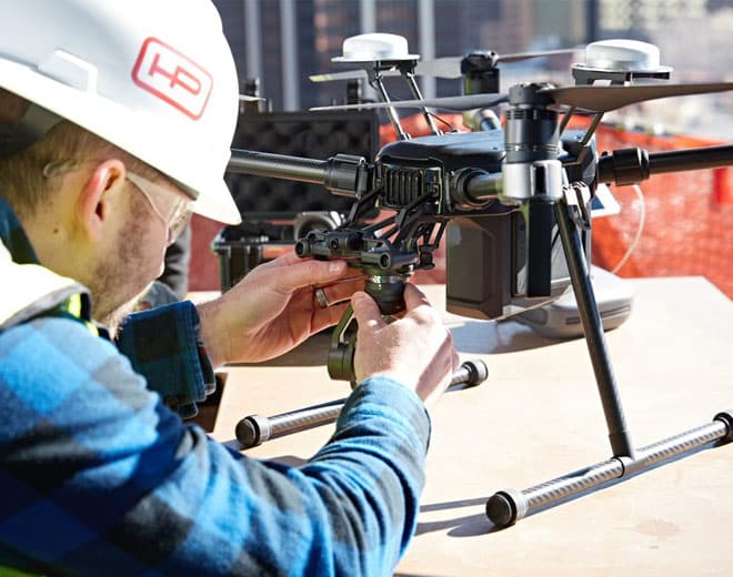
Drone Survey
Go to product
Service
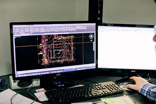
Land Surveying
Go to product
When exploring the Land Surveying industry in Poland, several key considerations come into play. Understanding the regulatory framework is crucial, as the industry is governed by specific national laws and EU directives that dictate standards and practices. Professionals must be aware of the licensing requirements and qualifications needed to operate legally. Challenges in this field include keeping pace with technological advancements, such as the integration of GIS and drone surveying, which require ongoing training and adaptation. Opportunities are abundant, particularly due to Poland's growing infrastructure projects and urban development initiatives, which create demand for accurate land assessments and planning. Environmental concerns, including sustainable land use and adherence to regulations regarding protected areas, are increasingly important in survey projects. The competitive landscape is characterized by both established firms and emerging startups, making it essential for newcomers to differentiate themselves through quality and innovation. Moreover, Poland's position within the EU offers potential for collaboration with international firms, tapping into the global market's relevance. As the country continues to modernize its infrastructure and embrace technology, the Land Surveying industry presents a dynamic environment for growth and professional development.
Some interesting numbers and facts about your company results for Land Surveying
| Country with most fitting companies | Poland |
| Amount of fitting manufacturers | 11 |
| Amount of suitable service providers | 11 |
| Average amount of employees | 1-10 |
| Oldest suiting company | 2000 |
| Youngest suiting company | 2021 |
Some interesting questions that has been asked about the results you have just received for Land Surveying
What are related technologies to Land Surveying?
Based on our calculations related technologies to Land Surveying are Education, Engineering Services, IT & Technology Services, Healthcare Services, Consulting
Who are Start-Ups in the field of Land Surveying?
Start-Ups who are working in Land Surveying are Orbify
Which industries are mostly working on Land Surveying?
The most represented industries which are working in Land Surveying are IT, Software and Services, Other, Chemicals, Construction, Oil, Energy and Gas
How does ensun find these Land Surveying Companies?
ensun uses an advanced search and ranking system capable of sifting through millions of companies and hundreds of millions of products and services to identify suitable matches. This is achieved by leveraging cutting-edge technologies, including Artificial Intelligence.