
The B2B platform for the best purchasing descision. Identify and compare relevant B2B manufacturers, suppliers and retailers
Close
Filter
Result configuration
Continents
Select continent
Locations
Result types
Company type
Select company type
Industries
Select industry
Company status
Select company status preset
Number of employees
Min.
Max.
Founding year
Drones Monterrey
Monterrey, Mexico
D
1-10 Employees
2014
Key takeaway
En Drones Monterrey, they specialize in aerial photography and filming with drones, utilizing advanced technology like the Mavic 2 Zoom to provide high-quality dynamic shots. Their expertise and competitive pricing make them a go-to provider for aerial photography needs in Monterrey.
Reference
Core business
Drones Monterrey - Servicio De Renta De Drones En Monterrey
Drones Monterrey, Renta de drones en monterrey,servicio de drones,fotografía y video aéreo, imágenes aéreas, grabación y filmación aérea, Droneros Monterrey
Drones Pro
Ciudad Juárez, Mexico
D
1-10 Employees
2014
Key takeaway
Drones Pro México is a leading distributor and integrator of unmanned drone systems in Latin America, offering a wide variety of drones and accessories from top brands like DJI and Parrot. They specialize in drone solutions for agriculture, mining, public safety, and surveying.
Reference
Core business
Profile – Drones Pro
Especialistas en drones dedicados para agricultura, minería, seguridad pública y topografía. En Drones Pro México encontraras una gran variedad en Drones, Accesorios y Refacciones de las marcas DJI, Parrot, Yuneec, 3dr entre otros. Somos representantes de fabrica de los sensores Flir, Mapir, Parrot, Zenmuse, Sensys...
Moving Up Drones
Puebla City, Mexico
D
1-10 Employees
-
Key takeaway
Moving Up specializes in drone services, including aerial photography and video, making them well-equipped to enhance creative projects. With a decade of experience, they also offer rental options and training, ensuring clients have access to professional drone operations for various applications.
Reference
Core business
Venta de drones Puebla México - Reparación de drones -Renta de drones
En Moving Up nos dedicamos venta, renta raparación de drones. Nos encontramos en la ciudad de puebla, ofrecemos cursos para manejo de drones y asesoría en drones industriales
Looking for more accurate results?
Find the right companies for free by entering your custom query!
25M+ companies
250M+ products
Free to use
Capacitación para uso profesional de drones
Mexico
D
1-10 Employees
2014
Key takeaway
The company specializes in professional drone training and project development, offering specialized rental services for the industrial and construction sectors. With seven years of experience, they provide effective training and a range of drone services, including aerial monitoring and specialized inspections.
Reference
Core business
Drones México Inspección Aérea: Renta, proyectos y capacitación (B2B-E2E)
GeoSpectral
Querétaro, Mexico
D
1-10 Employees
2019
Key takeaway
GeoSpectral specializes in advanced drones that capture high-precision aerial imagery, making them ideal for commercial, advertising, cinematographic, and project monitoring applications. Their selection of DJI drones ensures impressive aerial shots that enhance the professionalism and value of various projects.
Reference
Core business
Venta de Drones; Consultoría en Agricultura; Geospectral
Venta de Drones; Somos distribuidores autorizados de drones DJI, ofrecemos consultoría sobre agricultura de precisión, realizamos fumigaciones con drones y más
Desde Arriba Drones
Hermosillo, Mexico
D
1-10 Employees
2016
Key takeaway
The company specializes in using drones for various applications, including 3D modeling, generating detailed maps, and providing aerial perspectives that can enhance agricultural monitoring and industrial inspections. Their drone photography capabilities enable precise measurements and the ability to track changes over time, making it a valuable tool for sectors like agriculture and construction.
Reference
Core business
Desde Arriba Drones - Drones en Sonora.
Piloteamos nuestros drones para la industria, la investigación y la producción de medios en Sonora. Desde Arriba se ve mejor.
Propeller_Mx
Mexico
D
11-50 Employees
2010
Key takeaway
Propeller is a specialized team with extensive experience in photogrammetry and topographic surveys, which are essential for applications like land use studies and resource inventory. Their focus on precision and quality positions them as experts in drone photography and advanced engineering projects.
Reference
Core business
INICIO- Propeller ✅ Especialistas en Proyectos de ingeniería
Especialistas en Proyectos de ingeniería Geociencias, estudios cartográficos, fotogramétricos, topográficos y fotogramétricos diseño e implementación de software e infraestructura tecnológica.
GA Creativa
Querétaro, Mexico
D
1-10 Employees
2015
Key takeaway
The company, GA-Drone, specializes in drone photography and videography, creating dynamic visual content that enhances brand storytelling and impact. Their focus on high-quality audiovisual production helps businesses effectively showcase their offerings and achieve strategic goals.
Reference
Core business
Videos corporativos – Videos publicitarios y videos institucionales
GeoEarth
Mexico
D
11-50 Employees
2019
Key takeaway
GEOEARTH is a leader in geospatial technology and solutions, specializing in LiDAR surveys, including those conducted with UAVs, which offer high precision and point density essential for various projects. Their expertise also extends to satellite imagery analysis, providing valuable insights for applications like environmental monitoring and mining.
Reference
Core business
Servicios Geoespaciales
Laser y GPS
Irapuato, Mexico
D
51-100 Employees
1998
Key takeaway
The company specializes in providing high-precision technology, including drones for agricultural mapping, which enhances efficiency and performance in farming activities in Mexico.
Reference
Product
Dron para mapeo agrícola - Laser y GPS
Technologies which have been searched by others and may be interesting for you:
A selection of suitable products and services provided by verified companies according to your search.
Service
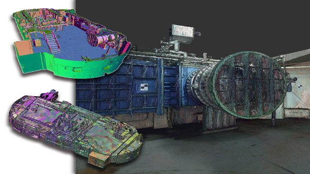
Reality Capture & CAD Services
Go to product

Service
A.Rrajani Photography
Go to product
Service
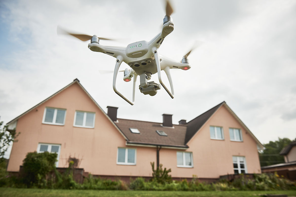
real estate drone photography
Go to product
Service
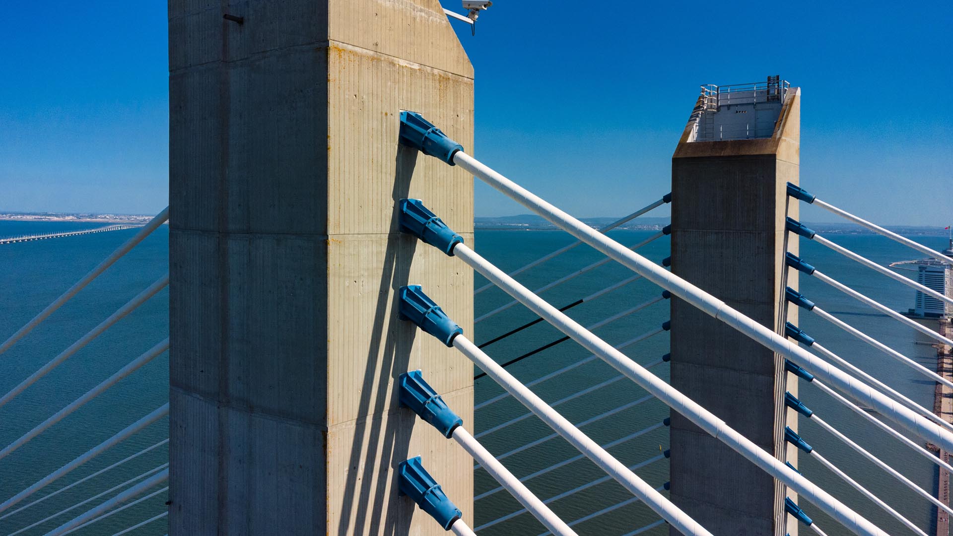
Aerial Drone Photography and Inspection
Go to product
A selection of suitable use cases for products or services provided by verified companies according to your search.
Use case
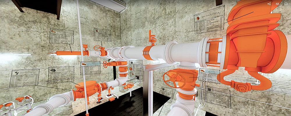
Reality Capture + Asset Information Modeling
Manufacturing, Factory, Production Plant
PMI was asked to participate in a pump station renovation in which asset and building life cycle management were high priority. Capturing post demolition conditions with terrestrial laser scanning assisted with the design process, and scanning final construction validated construction, graduating the design documents to as record drawing relevant for management of the building life cycle. The record drawings feature asset data such as model information and serial numbers for major equipment, key information for maintenance and repair.
Use case
Aerial Video and Photography
Ortophotography, Aerial Mapping, Real Estate, Advertising, Marketing, Sports, Corporate Marketing, Construction
Serviços que podemos oferecer: Inspeções a estruturas e edifícios, telhados, instalações industriais, antenas de comunicação, cabos de alta tensão ou redes eléctricas suspensas. Mapeamento aéreo de terrenos, infraestruturas ou pontos de interesse. Ánalise detalhada de pequenas e grandes áreas com alto nível de resolução espacial. Captação de imagens aéreas para o sector dos transportes e mobilidade urbana. Estaleiros e infraestruturas navais, sistemas ferroviários e rodoviários. Imagens aéreas para o sector do turismo e hotelaria; hotéis, resorts turísticos, alojamentos locais, pontos de interesse turísticos ou eventos relacionados. Captação e cobertura de eventos relacionados com a arte e cultura; concertos ou festivais, arte urbana ou exposições interiores ou ao ar livre. Captação de imagens para eventos desportivos, promoção de eventos e associações desportivas ou infraestruturas relacionadas com o desporto.

Use case
Reality Capture + Asset Information Modeling
Manufacturing, Factory, Production Plant
PMI was asked to participate in a pump station renovation in which asset and building life cycle management were high priority. Capturing post demolition conditions with terrestrial laser scanning assisted with the design process, and scanning final construction validated construction, graduating the design documents to as record drawing relevant for management of the building life cycle. The record drawings feature asset data such as model information and serial numbers for major equipment, key information for maintenance and repair.
When exploring the Drone Photography industry in Mexico, several key considerations are crucial. Regulatory compliance is paramount, as the Mexican government has established specific guidelines for drone usage, including licensing, registration, and operational restrictions. Understanding these regulations will help navigate legal challenges and avoid penalties. The competitive landscape is evolving, with a mix of local startups and established firms offering diverse services, from real estate photography to tourism and environmental monitoring. Identifying unique value propositions in this crowded market can provide a competitive edge. Additionally, opportunities abound in sectors such as agriculture, where drone technology is transforming crop monitoring and management. However, environmental concerns, particularly regarding wildlife and protected areas, must be taken into account, as certain regions may have restrictions on drone operations to minimize disturbance. The global market relevance of drone photography continues to grow, presenting avenues for collaboration with international companies and clients. Researching established players, emerging trends, and technological advancements is vital for success. Overall, a deep understanding of these factors will facilitate informed decision-making for anyone interested in entering the Drone Photography industry in Mexico.
Some interesting numbers and facts about your company results for Drone Photography
| Country with most fitting companies | Mexico |
| Amount of fitting manufacturers | 3 |
| Amount of suitable service providers | 7 |
| Average amount of employees | 1-10 |
| Oldest suiting company | 1998 |
| Youngest suiting company | 2019 |
Some interesting questions that has been asked about the results you have just received for Drone Photography
What are related technologies to Drone Photography?
Based on our calculations related technologies to Drone Photography are Big Data, E-Health, Retail Tech, Artificial Intelligence & Machine Learning, E-Commerce
Which industries are mostly working on Drone Photography?
The most represented industries which are working in Drone Photography are Marketing Services, Media and Entertainment, Aviation and Aerospace, IT, Software and Services, Other
How does ensun find these Drone Photography Companies?
ensun uses an advanced search and ranking system capable of sifting through millions of companies and hundreds of millions of products and services to identify suitable matches. This is achieved by leveraging cutting-edge technologies, including Artificial Intelligence.