The B2B platform for the best purchasing descision. Identify and compare relevant B2B manufacturers, suppliers and retailers
Close
Filter
Result configuration
Continents
Select continent
Locations
Result types
Company type
Select company type
Industries
Select industry
Company status
Select company status preset
Number of employees
Min.
Max.
Founding year
Lux Modus Ltd.
Calgary, Canada
A
1-10 Employees
2017
Key takeaway
Lux Modus offers LiDAR services that emphasize flexibility in data collection and delivery, reducing overall costs for customers while providing efficient 3D data collection. Their approach includes affordable equipment that integrates software and data processing, differentiating them from traditional mobile mapping manufacturers.
Reference
Service
LiDAR as a Service | Lux Modus
Airborne Imaging
Calgary, Canada
A
51-100 Employees
2004
Key takeaway
Airborne Imaging, a prominent provider of geospatial services, specializes in aerial LiDAR and imaging sensors, offering extensive capabilities for mapping critical infrastructure across North America. With the largest sensor capacity among North American LiDAR providers and nearly two decades of experience, they deliver high-quality geospatial data and create accurate terrain models for various industries.
Reference
Core business
Airborne Imaging Inc. – Airborne Imaging Inc.
Stratus Aerial Geomatics
Canada
A
1-10 Employees
2020
Key takeaway
Stratus Aerial Geomatics specializes in LiDAR, offering advanced solutions for geodetic measurements through UAV remote sensing. Their expertise includes data acquisition, processing, and analysis, making them a comprehensive resource for projects requiring precise 3D mapping and surveying.
Reference
Core business
Stratus Aerial Geomatics – 3D Mapping and LiDAR Services
Specializes in construction surveying. Survey-grade LiDAR, layouts, inspections, topos, CAD processing and analysis services. Tech-forward surveying!
Looking for more accurate results?
Find the right companies for free by entering your custom query!
25M+ companies
250M+ products
Free to use

NPRS
Barrie, Canada
A
1-10 Employees
-
Key takeaway
The company specializes in LiDAR services, offering various types such as Drone, Airborne, and Terrestrial LiDAR, alongside expertise in drone surveying and aerial photography. Their advanced technology ensures high accuracy and a wide range for data collection and extraction.
Reference
Core business
Northway Photomap North American LiDAR and Drone Services
Services include: LiDAR (Drone, Entertainment, Airborne, Terrestrial), 3D Scanning, Aerial Photography, Drone Surveying and Inspections
Eagle Mapping
City of Langley, Canada
A
11-50 Employees
-
Key takeaway
Eagle Mapping specializes in LiDAR data acquisition and processing, offering a wide range of geospatial products such as digital terrain models, vegetation density models, and orthophotos. With over 35 years of experience, the company ensures high-accuracy mapping solutions through its dedicated fleet of aircraft.
Reference
Service
Eagle Mapping Services - LiDAR & Aerial Mapping Solutions
Eagle Mapping provides LiDAR and aerial mapping services, specializing in acquisition, processing, and deliverables for geospatial solutions.
Hummingbird Drones
Kamloops, Canada
A
1-10 Employees
2014
Key takeaway
Hummingbird Drones™ specializes in providing RPAS services, with a particular focus on custom solutions for the forestry industry, including LiDAR technology. Their innovative approach and dedicated team enhance the value of their services and products, positioning them as a leader in the field.
Reference
Service
LiDAR — Hummingbird Drones
Geown Data Solutions
Vaudreuil-Dorion, Canada
A
1-10 Employees
-
Key takeaway
LP360 is an advanced desktop LiDAR software that simplifies the extraction of information from 3D point clouds, which are essential for mapping. It is designed to enhance the utilization of both airborne and terrestrial LiDAR data in a user-friendly GIS environment.
Reference
Core business
LP360 Drone and LP360 Geospatial to ensure you maximize your airborne/mobile LiDAR data - LP360
Drone Bees
Hamilton, Canada
A
1-10 Employees
2016
Key takeaway
The company specializes in providing LiDAR scanning solutions through drone services, offering fast and accurate data collection that can enhance site inspections and 3D modeling. Their expertise in LiDAR technology allows clients to efficiently visualize and analyze landscapes, even in densely vegetated areas.
Reference
Service
3D LiDAR - Drone Services Canada Inc.
Need to see through the trees? Call us today at +1 (905) 481 0112 for a FREE estimate! LiDAR scanning solutions.
CartoCanada
Calgary, Canada
A
1-10 Employees
2019
Key takeaway
CartoCanada specializes in providing industry-leading solutions, including mobile LiDAR, to meet diverse geospatial needs. Their commitment to consulting and training ensures clients have the right equipment and support for successful mapping and inspection operations.
Reference
Product
LiDAR Software Archive – CartoCanada
Set your data free with the world's most advanced and user-friendly lidar software .
aerogeo.com
Vancouver, Canada
A
1-10 Employees
1975
Key takeaway
AeroGeo specializes in LiDAR services, offering both airborne and terrestrial options, alongside a range of related surveying and mapping technologies. Their commitment to quality and precision is supported by qualified geomatics experts and state-of-the-art equipment, ensuring high data accuracy for diverse applications.
Reference
Product
Technology | Aerogeo
Technologies which have been searched by others and may be interesting for you:
A selection of suitable products and services provided by verified companies according to your search.

Service
Reality Capture & CAD Services
Go to product
A selection of suitable use cases for products or services provided by verified companies according to your search.

Use case
Reality Capture + Asset Information Modeling
Manufacturing, Factory, Production Plant
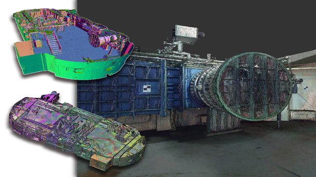
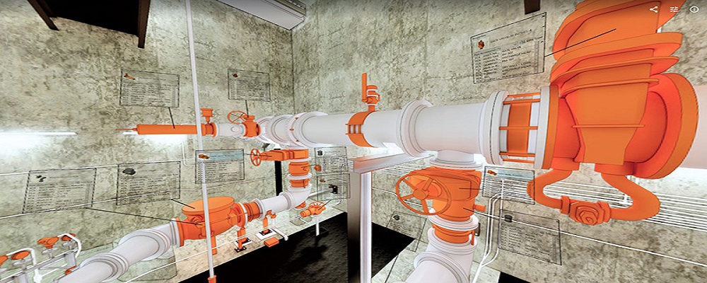
PMI was asked to participate in a pump station renovation in which asset and building life cycle management were high priority. Capturing post demolition conditions with terrestrial laser scanning assisted with the design process, and scanning final construction validated construction, graduating the design documents to as record drawing relevant for management of the building life cycle. The record drawings feature asset data such as model information and serial numbers for major equipment, key information for maintenance and repair.
When exploring the LiDAR industry in Canada, several key considerations are essential. The regulatory environment is crucial, as companies must comply with federal and provincial laws regarding data collection and privacy. Understanding the technological advancements and applications of LiDAR, from forestry and agriculture to urban planning and environmental monitoring, is vital for identifying market opportunities. Challenges such as the high cost of equipment, the need for skilled personnel, and competition from alternative technologies can impact entry and growth in this sector. Additionally, environmental concerns are increasingly significant, as LiDAR is often used for projects that may affect natural habitats or ecosystems. Companies must be prepared to address these issues and demonstrate sustainability in their practices. The competitive landscape is evolving, with both established players and startups vying for market share; therefore, keeping abreast of industry trends and innovations is important. Lastly, Canada's position in the global market for LiDAR technology plays a role in shaping local industry dynamics, as demand for precise geospatial data continues to grow worldwide. Understanding these factors allows potential entrants to make informed decisions and strategically position themselves in the LiDAR market.
Some interesting numbers and facts about your company results for LiDAR
| Country with most fitting companies | Canada |
| Amount of fitting manufacturers | 588 |
| Amount of suitable service providers | 531 |
| Average amount of employees | 1-10 |
| Oldest suiting company | 1975 |
| Youngest suiting company | 2020 |
Some interesting questions that has been asked about the results you have just received for LiDAR
What are related technologies to LiDAR?
Based on our calculations related technologies to LiDAR are Magnets, Printed Electronics, Industrial Amplifiers, Electronic Transducers, Electronic Oscillators
Which industries are mostly working on LiDAR?
The most represented industries which are working in LiDAR are IT, Software and Services, Other, Construction, Oil, Energy and Gas, Aviation and Aerospace
How does ensun find these LiDAR Companies?
ensun uses an advanced search and ranking system capable of sifting through millions of companies and hundreds of millions of products and services to identify suitable matches. This is achieved by leveraging cutting-edge technologies, including Artificial Intelligence.