The B2B platform for the best purchasing descision. Identify and compare relevant B2B manufacturers, suppliers and retailers
Close
Filter
Result configuration
Continents
Select continent
Locations
Result types
Company type
Select company type
Industries
Select industry
Company status
Select company status preset
Number of employees
Min.
Max.
Founding year

LiDAR.CO.UK
Exeter, United Kingdom
A
1-10 Employees
-
Key takeaway
The company offers comprehensive LiDAR services, including ground and aerial scanning, processing LiDAR data, and producing digital products like Digital Elevation Models. Their expertise extends to applications in archaeology, forestry, flood modeling, and infrastructure development, making them a valuable resource for various industries.
Reference
Core business
LiDAR mapping and monitoring, fixed wing, helicopter or UAV
LiDAR Scotland
Uddingston, United Kingdom
A
1-10 Employees
2023
Key takeaway
LiDAR Scotland specializes in producing terrain point clouds and digital terrain maps using advanced LiDAR technology, particularly through drone deployments. With seven years of experience, they deliver high-quality data and have developed unique post-processing techniques to enhance the accuracy of their topographic data.
Reference
Product
Equipment - Lidar Scotland
At LiDAR Scotland, we deploy industry leading technology to ensure that we capture data and produce deliverables as agreed. Our unique in house planning and post processing procedures have been ...
Routescene
City of Edinburgh, United Kingdom
A
11-50 Employees
2005
Key takeaway
The Routescene drone LiDAR mapping solution offers a comprehensive package that includes reliable hardware and advanced data processing software, making it ideal for applications in environmental, forestry, and geospatial research. Their LidarViewer Pro is highlighted as a top choice for simplifying and enhancing the efficiency of LiDAR data processing.
Reference
Product
LiDAR point cloud mapping software - Routescene
Developed for LiDAR survey data, 5 reasons why our LiDAR point cloud mapping software simplifies and reduces your data processing time.
Looking for more accurate results?
Find the right companies for free by entering your custom query!
25M+ companies
250M+ products
Free to use
Carbomap
City of Edinburgh, United Kingdom
A
1-10 Employees
2012
Key takeaway
The company specializes in extracting 3D metrics from land and forests using advanced LiDAR technology, including multi-spectral and UAV-LiDAR, which is essential for inventory, planning, and carbon accounting. Their expertise in LiDAR and radar analysis, combined with innovative tools and machine learning algorithms, enables them to enhance access to valuable spatial data for various applications.
Reference
Core business
Forest Mapping | Carbomap | Edinburgh
Carbomap is about making space data available for everyone. Forest mapping. Lidar processing. Satellite radar processing.
Mapix technologies
City of Edinburgh, United Kingdom
A
11-50 Employees
1996
Key takeaway
Mapix Technologies is a leading distributor of Velodyne and LeddarTech LiDAR products in several European countries. With over 20 years of experience, the company provides a range of LiDAR sensors for applications in industrial automation, robotics, and autonomous vehicles, ensuring their products meet European legislation standards.
Reference
Service
Mapix technologies | leading authority in mapping, LiDAR sensors and solutions
With over 20 years of experience in LiDAR, we are experts in the fields of mapping, autonomous vehicles, industrial and robotics.
RIEGL UK Ltd
United Kingdom
A
1-10 Employees
2020
Key takeaway
RIEGL is a prominent manufacturer of advanced LiDAR technology, offering a diverse range of laser scanning solutions for various applications, including topography, civil engineering, and heritage preservation. With over 40 years of experience in producing commercial LiDAR systems, RIEGL ensures detailed and accurate 3D data collection through its innovative pulsed time-of-flight laser radar technology.
Reference
Core business
Laser Scanning Equipment Supplier | RIEGL UK Ltd | Heslington
RIEGL is an international provider of cutting edge laser scanning technology for airborne, mobile, terrestrial and unmanned sectors. RIEGL has commerically produced LiDAR systems for 40 years. RIEGL UK Ltd is your local office for technical sales and information, laser scanners and software support.
Aerialsurvey
United Kingdom
A
1-10 Employees
-
Key takeaway
ClearSkies Geomatics, through its AERIALSURVEY.com portal, specializes in remote sensing technologies, including LiDAR solutions, offering high-quality pre-owned LiDAR and aerial survey equipment for lease. They have extensive experience in this field, making them a valuable resource for clients seeking sophisticated geospatial mapping systems.
Reference
Product
Pre-Owned Lidar & Aerial Survey Equipment For Lease
Remote sensing lidar sensor for geospatial mapping

ProDroneWorx
United Kingdom
A
1-10 Employees
2016
Key takeaway
ProDroneWorx specializes in digital inspection and surveying using advanced technologies, including aerial LiDAR surveys. With over seven years of experience, they provide clients with accurate 2D/3D digital data to enhance asset management and decision-making.
Reference
Service
Aerial LiDAR Survey Services - ProDroneWorx
Drone Surveying
Walsall, United Kingdom
A
1-10 Employees
2016
Key takeaway
Drone Surveying specializes in providing advanced survey services to the construction industry, utilizing high specification drones and industry-leading software to create precise imagery. Their LiDAR inspection capabilities enhance site management by allowing clients to analyze measurements and view detailed recordings throughout the construction process.
Reference
Service
LiDAR Inspection – Drone Surveying
NWT ASSOCIATES LTD
Birkenhead, United Kingdom
A
1-10 Employees
-
Key takeaway
Ollerhead & Associates Ltd. specializes in terrestrial LiDAR, highlighting their expertise in advanced surveying techniques. Their certified professionals ensure high standards and safety in all surveying projects.
Reference
Service
TRESTRIAL-LIDAR - Ollerhead & Associates Ltd.
Technologies which have been searched by others and may be interesting for you:
A selection of suitable products and services provided by verified companies according to your search.

Service
Reality Capture & CAD Services
Go to product
A selection of suitable use cases for products or services provided by verified companies according to your search.

Use case
Reality Capture + Asset Information Modeling
Manufacturing, Factory, Production Plant
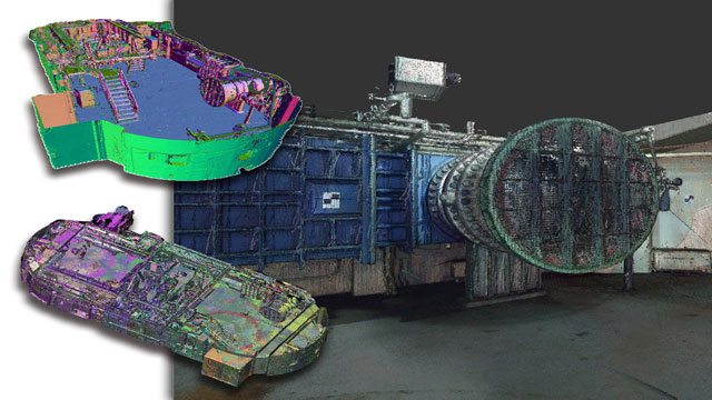
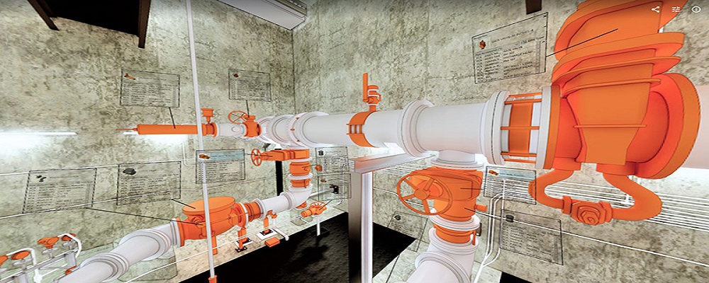
PMI was asked to participate in a pump station renovation in which asset and building life cycle management were high priority. Capturing post demolition conditions with terrestrial laser scanning assisted with the design process, and scanning final construction validated construction, graduating the design documents to as record drawing relevant for management of the building life cycle. The record drawings feature asset data such as model information and serial numbers for major equipment, key information for maintenance and repair.
When exploring the LiDAR industry in the United Kingdom, several key considerations emerge. Firstly, understanding the regulatory framework is essential, as compliance with data protection laws, such as GDPR, is critical when handling geospatial data. The UK government has been supportive of technological advancements, providing funding opportunities and fostering innovation through initiatives like the UK Space Agency. Challenges in the industry include the high costs associated with LiDAR technology and the need for skilled personnel to operate and interpret the data effectively. Environmental concerns also play a significant role, as companies must ensure that their operations do not negatively impact ecosystems, particularly in sensitive areas. The competitive landscape in the UK features a mix of established players and emerging startups, all vying for market share in diverse sectors such as forestry, agriculture, and urban planning. Global market relevance is noteworthy, as the UK is part of a growing international LiDAR market driven by advancements in autonomous vehicles, mapping, and surveying. Staying informed about technological trends and industry demands will help navigate this dynamic field successfully.
Some interesting numbers and facts about your company results for LiDAR
| Country with most fitting companies | United Kingdom |
| Amount of fitting manufacturers | 1276 |
| Amount of suitable service providers | 1540 |
| Average amount of employees | 1-10 |
| Oldest suiting company | 1996 |
| Youngest suiting company | 2023 |
Some interesting questions that has been asked about the results you have just received for LiDAR
What are related technologies to LiDAR?
Based on our calculations related technologies to LiDAR are Magnets, Printed Electronics, Industrial Amplifiers, Electronic Transducers, Electronic Oscillators
Who are Start-Ups in the field of LiDAR?
Start-Ups who are working in LiDAR are LiDAR Scotland
Which industries are mostly working on LiDAR?
The most represented industries which are working in LiDAR are IT, Software and Services, Other, Construction, Electronics and Electrical engineering, Aviation and Aerospace
How does ensun find these LiDAR Companies?
ensun uses an advanced search and ranking system capable of sifting through millions of companies and hundreds of millions of products and services to identify suitable matches. This is achieved by leveraging cutting-edge technologies, including Artificial Intelligence.