Locations
Company type
Result types
Industries
Employees
Founding year

The B2B platform for the best purchasing descision. Identify and compare relevant B2B manufacturers, suppliers and retailers
Close
Filter
Result configuration
Continents
Select continent
Locations
Result types
Company type
Select company type
Industries
Select industry
Company status
Select company status preset
Number of employees
Min.
Max.
Founding year
Drone For Canada Inc.
Beaumont, Canada
A
1-10 Employees
2017
Key takeaway
Drone mapping is an innovative tool that enables quick and safe capture of high-resolution aerial views, ideal for inspections and site assessments. The company's use of both fixed-wing and multirotor UAVs, combined with advanced photogrammetry software, facilitates the creation of detailed orthophotos and digital elevation models, benefiting various applications like site design and safety planning.
Reference
Product
GEOSPATIAL - Drone For Canada
We use fixed wing and multirotor UAVs to acquire high resolution aerial images. This imagery is processed using advanced photogrammetry software to generate orthophotos, digital elevation models and panoramic images of a site. This type of imagery is commonly used for site design, health and ... Read More
CartoCanada
Calgary, Canada
A
1-10 Employees
2019
Key takeaway
CartoCanada offers a comprehensive range of aerial mapping drones and related geospatial equipment, emphasizing their commitment to providing industry-leading solutions for drone mapping and inspection. Their services include training and support, ensuring clients effectively utilize their advanced mapping technologies like Pix4Dcloud for efficient aerial image analysis.
Reference
Product
Pix4Dmodel Drone Software – CartoCanada
The cloud-based processing solution for fast and easy aerial image analysis. Upload your drone imagery via the web or directly from mobile devices using our Android or iOS apps and let Pix4Dcloud do the rest.
Aeromao
Mississauga, Canada
A
1-10 Employees
2011
Key takeaway
Aeromao is a leading Canadian UAV manufacturer that specializes in survey-grade drones, including the Aeromapper series designed for mapping and surveying. They offer comprehensive drone mapping services, training, and operational support, ensuring clients can effectively collect and analyze data for informed decision-making.
Reference
Service
Services | Aeromao
Our Services We deliver data driven comprehensive services. Our expert staff has a long track of experience in capturing the most comprehensive, high-quality data anywhere in the world, in any environment. No project is too big or too small. Contact us now with your requirements and we’ll help you to take your project from concept
Looking for more accurate results?
Find the right companies for free by entering your custom query!
25M+ companies
250M+ products
Free to use
Spexi Geospatial
Vancouver, Canada
A
1-10 Employees
2018
Key takeaway
Spexi is setting a new standard for ultra-high resolution drone imagery, leveraging sub-250g micro drones to provide detailed aerial imagery that can benefit various sectors such as construction, real estate, and agriculture. With over 20 years of experience in geospatial imagery, the company combines innovative drone technology and software to create a scalable platform for drone-based data collection.
Reference
Core business
Scalable Aerial Drone Operations | Spexi Geospatial
An intuitive and collaborative platform for drone-based data
Candrone
Burnaby, Canada
A
11-50 Employees
2009
Key takeaway
Candrone is a leader in providing enterprise-grade drone and sensor solutions, emphasizing the importance of data-driven decision-making. Their offerings include LiMapper, a photogrammetry software that enhances drone mapping capabilities.
Reference
Product
Buy LiMapper For Drones Online | Candrone – Candrone
Canadian UAV Solutions
Barrie, Canada
A
1-10 Employees
2018
Key takeaway
Volatus Aerospace offers a range of drone services that are ideal for aerial imaging and video needs, including aerial surveying and topographic mapping. With over seven years of experience and a team of certified professionals, they ensure high-quality 3D processing and compliance with Canadian drone regulations.
Reference
Core business
UAV and Drone Aerial Imaging Services | Volatus Aerospace
Volatus Aerospace specializes in Aerial imaging services, including Drone surveying, inspection and more!
Hummingbird Drones
Kamloops, Canada
A
1-10 Employees
2014
Key takeaway
Hummingbird Drones™ specializes in providing advanced RPAS services, including topography mapping, which is essential for various applications. Their innovative approach and dedicated team ensure high-quality deliverables that enhance operational efficiency in the forestry industry.
Reference
Service
Topography Mapping — Hummingbird Drones
UnmannedRC
Regina, Canada
A
11-50 Employees
-
Key takeaway
UnmannedRC specializes in drone technology, offering a range of products and services, including the UnmannedRC Dragon EPO VTOL Plane specifically designed for drone mapping and aerial surveying. They also provide various mapping cameras and emphasize making UAV technology accessible for both hobbyists and professionals.
Reference
Core business
UnmannedRC -Unmanned Aircraft Systems and Professional Mapping Cameras
UnmannedRC is a trading name of ADTi (Aerial Dynamic Technologies and Innovations), ADTi is a professional UAV and ground control system designing and manufacturing company in China.
ASPECT Drone Solutions
Waterloo, Canada
A
1-10 Employees
2021
Key takeaway
The company specializes in Structure-from-Motion photogrammetry, using drone imagery to create high-resolution maps and 3D elevation models. Their expertise in aerial site mapping and 3D mapping is particularly beneficial for sectors like construction, mining, and real estate.
Reference
Product
Solutions — ASPECT Drone Solutions
VividAir
Orangeville, Canada
A
1-10 Employees
-
Key takeaway
Vividair is a specialized UAV/drone aerial photography company that offers services such as mapping, surveying, and inspections. They emphasize the efficiency and safety of drone mapping, which is crucial for identifying safety or building issues early, ultimately enhancing profit margins through powerful insights and a unique visual perspective.
Reference
Core business
Vivid Air - Professional Drone Photography
A Professional Drone Photography, high quality and affordable UAV services company specializing in aerial photography, mapping, surveying, inspections and data gathering utilizing drone technology.
Technologies which have been searched by others and may be interesting for you:
A selection of suitable products and services provided by verified companies according to your search.
Service
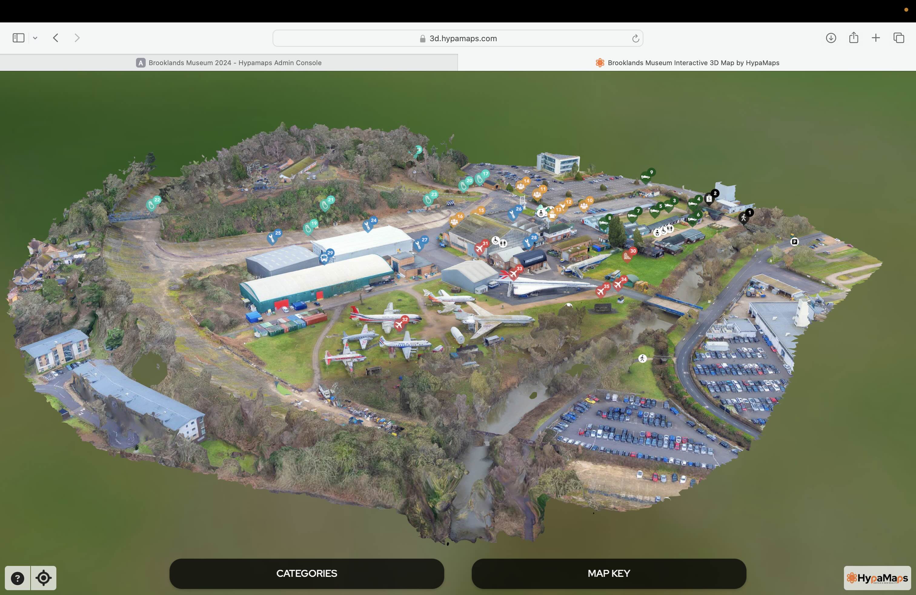
Interactive 3d Maps
Go to product
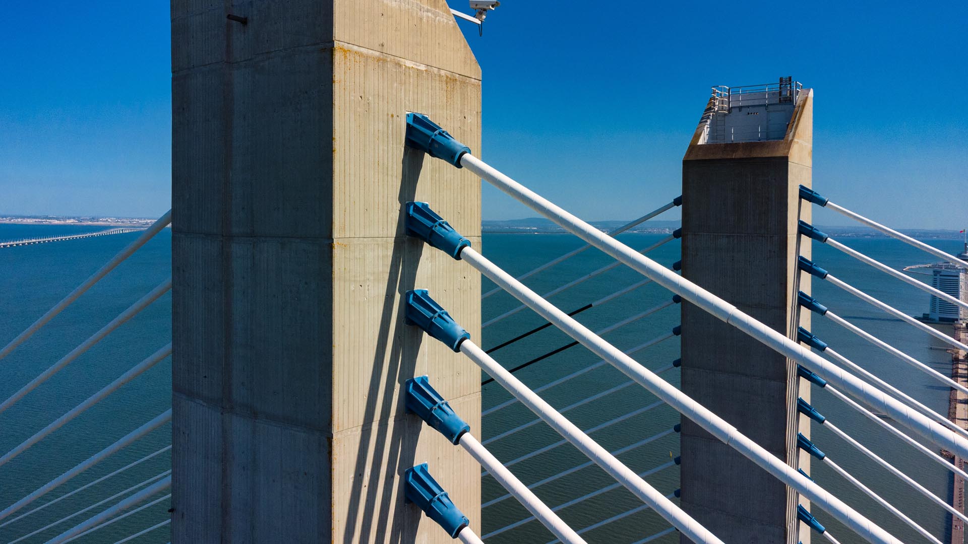
Service
Aerial Drone Photography and Inspection
Go to product
A selection of suitable use cases for products or services provided by verified companies according to your search.
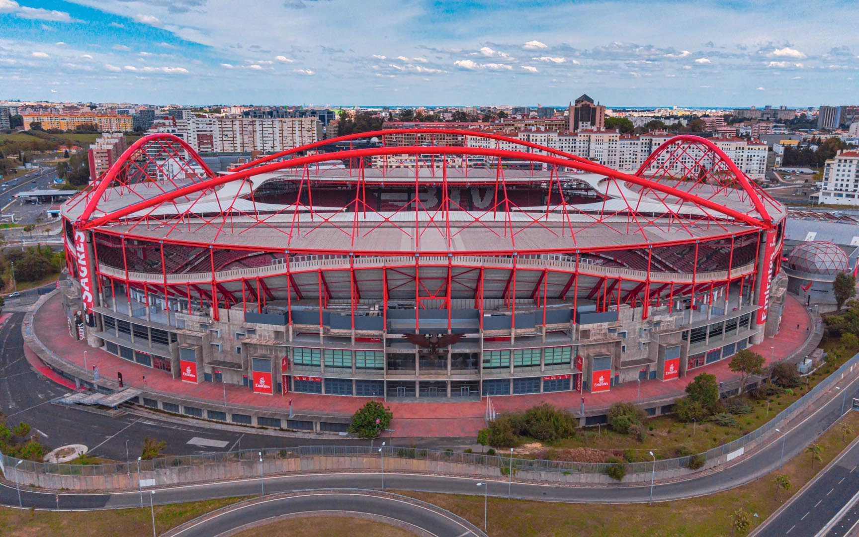
Use case
Aerial Video and Photography
Ortophotography, Aerial Mapping, Real Estate, Advertising, Marketing, Sports, Corporate Marketing, Construction
Serviços que podemos oferecer: Inspeções a estruturas e edifícios, telhados, instalações industriais, antenas de comunicação, cabos de alta tensão ou redes eléctricas suspensas. Mapeamento aéreo de terrenos, infraestruturas ou pontos de interesse. Ánalise detalhada de pequenas e grandes áreas com alto nível de resolução espacial. Captação de imagens aéreas para o sector dos transportes e mobilidade urbana. Estaleiros e infraestruturas navais, sistemas ferroviários e rodoviários. Imagens aéreas para o sector do turismo e hotelaria; hotéis, resorts turísticos, alojamentos locais, pontos de interesse turísticos ou eventos relacionados. Captação e cobertura de eventos relacionados com a arte e cultura; concertos ou festivais, arte urbana ou exposições interiores ou ao ar livre. Captação de imagens para eventos desportivos, promoção de eventos e associações desportivas ou infraestruturas relacionadas com o desporto.
When exploring the Drone Mapping industry in Canada, several key factors should be considered. Firstly, compliance with Transport Canada regulations is crucial, as strict guidelines govern drone operations, including licensing requirements for pilots and safety protocols for commercial use. Understanding these regulations can help mitigate legal challenges and ensure safe operations. Additionally, the competitive landscape is becoming increasingly crowded, with numerous companies entering the market. It’s important to assess the technological capabilities and unique offerings of potential partners or suppliers. The demand for drone mapping services spans various sectors, including agriculture, construction, and environmental monitoring, presenting significant opportunities for growth. However, challenges such as weather conditions and technical limitations of drones can affect data accuracy and operational efficiency. Environmental concerns also play a role, as projects should consider impacts on wildlife and ecosystems. Finally, Canada’s place in the global drone mapping market is significant, with innovations and advancements being made that position the country as a leader in drone technology. By keeping these considerations in mind, individuals can make informed decisions when researching companies in the Drone Mapping industry in Canada, ultimately leading to successful engagements in this evolving field.
Some interesting numbers and facts about your company results for Drone Mapping
| Country with most fitting companies | Canada |
| Amount of fitting manufacturers | 440 |
| Amount of suitable service providers | 461 |
| Average amount of employees | 1-10 |
| Oldest suiting company | 2009 |
| Youngest suiting company | 2021 |
Some interesting questions that has been asked about the results you have just received for Drone Mapping
What are related technologies to Drone Mapping?
Based on our calculations related technologies to Drone Mapping are Big Data, E-Health, Retail Tech, Artificial Intelligence & Machine Learning, E-Commerce
Who are Start-Ups in the field of Drone Mapping?
Start-Ups who are working in Drone Mapping are ASPECT Drone Solutions
Which industries are mostly working on Drone Mapping?
The most represented industries which are working in Drone Mapping are IT, Software and Services, Aviation and Aerospace, Other, Construction, Oil, Energy and Gas
How does ensun find these Drone Mapping Companies?
ensun uses an advanced search and ranking system capable of sifting through millions of companies and hundreds of millions of products and services to identify suitable matches. This is achieved by leveraging cutting-edge technologies, including Artificial Intelligence.