The B2B platform for the best purchasing descision. Identify and compare relevant B2B manufacturers, suppliers and retailers
Close
Filter
Result configuration
Continents
Select continent
Locations
Result types
Company type
Select company type
Industries
Select industry
Company status
Select company status preset
Number of employees
Min.
Max.
Founding year
UK Drone Services Ltd
United Kingdom
A
1-10 Employees
-
Key takeaway
UK Drone Services Ltd specializes in drone mapping and 3D modeling, offering detailed three-dimensional representations of projects. Their expertise ensures accurate and reliable mapping for various applications, including aerial inspections and virtual tours.
Reference
Core business
UK Drone Services Ltd, FPV Flythrough Tours & Aerial Surveys
UK Drone Services, Drone Photography, Aerial Inspections, Thermal Inspections, Drone Videography and Mapping Services
Desire RC Ltd
Verwood, United Kingdom
A
1-10 Employees
-
Key takeaway
SkyPan offers highly accurate topographic maps through advanced drone technology, enabling you to identify weak areas and optimize crop yield. Their professional aerial photography and mapping services are designed to enhance productivity in the agriculture industry.
Reference
Service
Mapping & Photogrammetry – Sky Pan
Drone Inspect Services
Rushmoor, United Kingdom
A
1-10 Employees
2018
Key takeaway
The company specializes in drone mapping and surveying, utilizing advanced technologies like photogrammetry, RTK surveying, and SLAM-based LIDAR mapping to create highly accurate point clouds and models. With a team of experts and CAA certification, they ensure safe and efficient drone operations, enhancing workflows and delivering rapid results for clients.
Reference
Service
Surveying and 3D Mapping | Drone Inspection Services
Photogrammetry, RTK Surveying and SLAM Based LIDAR Mapping, creating the most consistent and accurate Point Clouds and Models available
Looking for more accurate results?
Find the right companies for free by entering your custom query!
25M+ companies
250M+ products
Free to use
Drone Surveying
Walsall, United Kingdom
A
1-10 Employees
2016
Key takeaway
Drone Surveying, founded by UK drone surveying expert Jim Morris, specializes in providing advanced drone mapping services that enhance site management for the construction industry. Utilizing high specification drones and industry-leading software, they create precise imagery and data sets that enable clients to analyze measurements and track construction progress effectively.
Reference
Service
Services – Drone Surveying
Drone Survey Solutions
West Lancashire, United Kingdom
A
1-10 Employees
2019
Key takeaway
Drone Survey Solutions specializes in aerial drone technology, offering high-resolution mapping and surveying services. Their experienced team ensures precision and quality, making them a reliable partner for any drone mapping project.
Reference
Core business
Drone Survey Solutions – "Where imagination takes flight"
Global Drone Surveys
Cardiff, United Kingdom
A
1-10 Employees
-
Key takeaway
Global Drone Surveys specializes in aerial drone mapping and inspections using advanced UAV technology, providing detailed imagery and surveys that are often faster and more cost-effective than traditional methods. Their services include close visual inspections and topographic surveys, making them a key player in the drone mapping industry.
Reference
Core business
Drone Survey and Drone Inspection Services
Global Drone Surveys is the Industry Leading UAV Inspection Drone Survey and Mapping company in the UK.
Heliguy
Newcastle upon Tyne, United Kingdom
A
11-50 Employees
2012
Key takeaway
The DeltaQuad Pro #MAP drone by the company offers advanced capabilities for aerial mapping, featuring a 61MP surveying sensor and options for RGB, thermal, or multi-spectral payloads. This versatility makes it a valuable tool for businesses looking to enhance their mapping and surveying processes.
Reference
Product
DeltaQuad #MAP Fixed-Wing VTOL Mapping Drone – heliguy™
The DeltaQuad Pro #MAP offers state-of-the-art features for easy and productive aerial mapping and can carry a 61MP surveying sensor. Versatile VTOL aircraft with RGB, thermal or multi-spectral payloads to build high-quality maps and models. Buy now.
E B Marine Ltd
Taunton, United Kingdom
A
1-10 Employees
2013
Key takeaway
EB Marine specializes in drone mapping and surveying, providing accurate and fully processed survey datasets using advanced Post-Processing Kinematic Survey solutions. Their services offer GIS professionals high-accuracy aerial surveys suitable for various land mapping applications.
Reference
Core business
EB Marine Aerial Mapping - EB Marine
From eye level to sky level We are drone mapping and surveying specialists We provide accurate and fully processed survey datasets Request a quote Reach new levels of accuracy High accuracy aerial surveys for a variety of land mapping applications…
DroneLab
Newcastle upon Tyne, United Kingdom
A
1-10 Employees
2014
Key takeaway
The company offers DroneLab, a specialized software for aerial surveys and mapping using UAVs, allowing users to share maps with clients on various devices.
Reference
Core business
DroneLab - Drone Software for Aerial Surveys & Mapping using UAVs
SkyView Mapping Ltd
United Kingdom
A
1-10 Employees
2021
Key takeaway
Skyview Mapping specializes in UAV data collection, offering a range of drone services from aerial surveys to 3D mapping, making it a leader in the field. With over 20 years of experience and a commitment to safety and professionalism, they provide high-quality data collection for sectors like construction and surveying.
Reference
Core business
Skyview Mapping LTD | Aerial Digital Imagery & Videos
What was once a hobby is now a profession: using the latest software to create spectacular precise imagery and videos.
Technologies which have been searched by others and may be interesting for you:
A selection of suitable products and services provided by verified companies according to your search.

Service
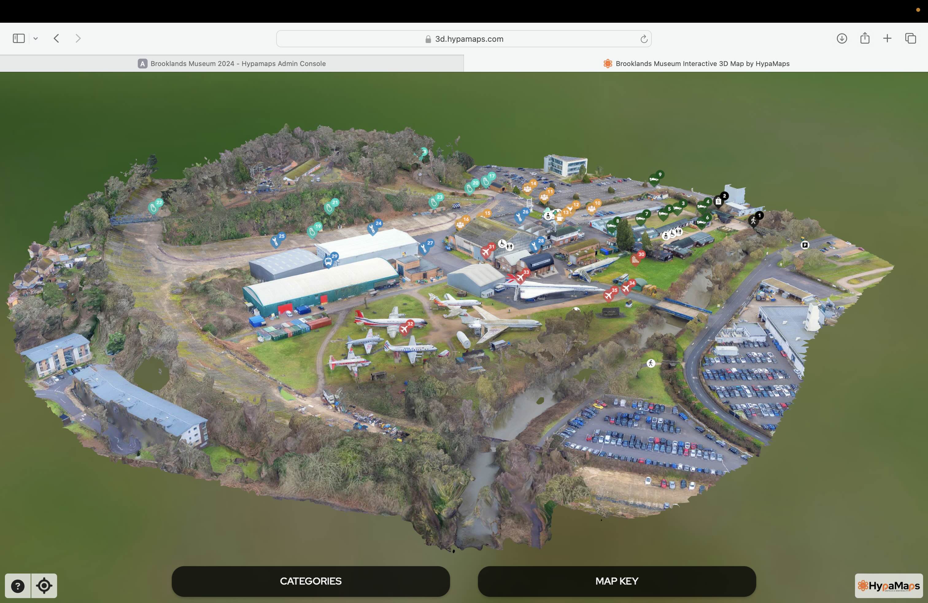
Interactive 3d Maps
Go to product

Service
Aerial Drone Photography and Inspection
Go to product
A selection of suitable use cases for products or services provided by verified companies according to your search.

Use case
Aerial Video and Photography
Ortophotography, Aerial Mapping, Real Estate, Advertising, Marketing, Sports, Corporate Marketing, Construction
Serviços que podemos oferecer: Inspeções a estruturas e edifícios, telhados, instalações industriais, antenas de comunicação, cabos de alta tensão ou redes eléctricas suspensas. Mapeamento aéreo de terrenos, infraestruturas ou pontos de interesse. Ánalise detalhada de pequenas e grandes áreas com alto nível de resolução espacial. Captação de imagens aéreas para o sector dos transportes e mobilidade urbana. Estaleiros e infraestruturas navais, sistemas ferroviários e rodoviários. Imagens aéreas para o sector do turismo e hotelaria; hotéis, resorts turísticos, alojamentos locais, pontos de interesse turísticos ou eventos relacionados. Captação e cobertura de eventos relacionados com a arte e cultura; concertos ou festivais, arte urbana ou exposições interiores ou ao ar livre. Captação de imagens para eventos desportivos, promoção de eventos e associações desportivas ou infraestruturas relacionadas com o desporto.
When exploring the Drone Mapping industry in the United Kingdom, several key considerations are crucial for informed decision-making. Regulations play a significant role, as the UK Civil Aviation Authority (CAA) enforces strict guidelines for drone operations, including licensing and operational limits. Understanding these regulations is vital for compliance and safety. Challenges in this sector often include data privacy concerns and the need for high-quality aerial imagery, which requires advanced technology and skilled personnel. However, opportunities abound, particularly in sectors like agriculture, construction, and environmental monitoring, where drone mapping enhances efficiency and accuracy. Environmental impact is another factor to consider, as the industry is increasingly focused on sustainable practices and minimizing ecological footprints. The competitive landscape is evolving, with numerous startups and established companies vying for market share, necessitating thorough research on available services and technological advancements. On a global scale, the drone mapping industry is experiencing rapid growth, driven by technological innovations and increasing demand for geospatial data. This global relevance further emphasizes the need for businesses to stay updated on international trends and practices, ensuring they remain competitive in a fast-paced market.
Some interesting numbers and facts about your company results for Drone Mapping
| Country with most fitting companies | United Kingdom |
| Amount of fitting manufacturers | 1066 |
| Amount of suitable service providers | 1552 |
| Average amount of employees | 1-10 |
| Oldest suiting company | 2012 |
| Youngest suiting company | 2021 |
Some interesting questions that has been asked about the results you have just received for Drone Mapping
What are related technologies to Drone Mapping?
Based on our calculations related technologies to Drone Mapping are Big Data, E-Health, Retail Tech, Artificial Intelligence & Machine Learning, E-Commerce
Who are Start-Ups in the field of Drone Mapping?
Start-Ups who are working in Drone Mapping are SkyView Mapping Ltd
Which industries are mostly working on Drone Mapping?
The most represented industries which are working in Drone Mapping are IT, Software and Services, Other, Construction, Aviation and Aerospace, Media and Entertainment
How does ensun find these Drone Mapping Companies?
ensun uses an advanced search and ranking system capable of sifting through millions of companies and hundreds of millions of products and services to identify suitable matches. This is achieved by leveraging cutting-edge technologies, including Artificial Intelligence.