Locations
Company type
Result types
Industries
Employees
Founding year

The B2B platform for the best purchasing descision. Identify and compare relevant B2B manufacturers, suppliers and retailers
Close
Filter
Result configuration
Continents
Select continent
Locations
Result types
Company type
Select company type
Industries
Select industry
Company status
Select company status preset
Number of employees
Min.
Max.
Founding year
GeoDrones
Even Yehuda, Israel
B
1-10 Employees
2015
Key takeaway
GeoDrones provides high-quality mapping services using advanced equipment and experienced remote pilots, ensuring they meet the needs of their customers effectively.
Reference
Service
Aerial Mapping | GeoDrones
Agrimapic
Holon, Israel
B
1-10 Employees
2015
Key takeaway
Agrimapic specializes in drone mapping through its advanced Photo Geometric Services, utilizing state-of-the-art autonomous drone systems to deliver high-resolution 2D and 3D images and models. Their technology, including the SkyMapper 1900 and ROBOMAPIC 680PRO, supports applications in agriculture, construction, and environmental conservation, providing valuable data to enhance crop yields and inform decision-making.
Reference
Core business
HOME | agrimapic
High Lander
Raanana, Israel
B
1-10 Employees
2018
Key takeaway
High Lander specializes in drone fleet management through its innovative platform, Mission Control, which enhances various drone operations like aerial security, public safety, and precision agriculture. Their Unmanned Traffic Management (UTM) solution ensures comprehensive airspace management, making it ideal for optimizing drone mapping and other applications.
Reference
Core business
High Lander | Drone Fleet Management & Autonomous Airspace Control | Israel
High Lander turns any drone into part of a fleet of autonomous super drones.
Looking for more accurate results?
Find the right companies for free by entering your custom query!
25M+ companies
250M+ products
Free to use
CopterPIX PRO
Rosh HaAyin, Israel
B
- Employees
2013
Key takeaway
CopterPIX, a deep-tech company established in 2013, specializes in developing advanced UAV solutions, including fully autonomous drones that can be applied to various challenges. Their proprietary technology enhances drone capabilities, making them effective for diverse applications, from civilian to defense use.
Reference
Product
ERE 95 Pro Hybrid – CopterPIX Pro
CopterPIX PRO Israeli deep-tech company that specializes in designing, developing and manufacturing unique and advanced UAV solutions for special assignments.
Airobotics
Drom HaSharon Regional Council, Israel
B
101-250 Employees
2014
Key takeaway
Airobotics specializes in developing reliable and effective automated drone systems that facilitate real-time aerial data capturing and analysis. Their end-to-end solutions and commitment to regulatory compliance position them as leaders in the drone industry, making them well-equipped to support various applications, including drone mapping.
Reference
Core business
Airobotics - Trusted Autonomous Drones
An Israeli manufacturer and operator of UAV systems deployed as aerial infrastructure for government and commercial entities.
Heven Drones
Israel
B
11-50 Employees
2019
Key takeaway
Heven Drones offers advanced, customizable drones designed for various missions, highlighting their cutting-edge performance and stability. This capability positions them as leaders in innovative solutions for applications such as autonomous delivery and emergency response.
Reference
Core business
About Us - Heven Drones
Our end-to-end actionable drones provide the cutting-edge performance, customization, and stability needed to accomplish any mission – bringing our customers to the forefront of their industry.
Agrowing
Rishon LeZion, Israel
B
- Employees
2014
Key takeaway
Agrowing specializes in precision agriculture through advanced imaging technologies, including high-resolution multispectral sensors that enable detailed AI analysis for detecting pests and diseases. Their innovative sensing methods and customizable lens options provide growers with immediate, actionable data, making them a valuable resource for enhanced agricultural practices.
Reference
Product
Topo Drone - AGROWING
topodrone 61MP CAMERA WITH AGROWING DUAL/QUAD/SEXTUPLEM200/210/300 PSDK Professional modified camera with TOPODRONE LiDAR support and 61 Mp resolution, full frame sensor, mechanical shutter, ISO 100-25600, 24 mm lens, weighs 450 g. DJI Matrice 200/210300 PSDK More Information Type: Dual purpose: Spectral bands: DJI Matrice 300 Dual Purpose (RGB/Multispectral) sensor Multispectral based on Panchromatic with Agrowing […]
Flying production
Drom HaSharon Regional Council, Israel
B
11-50 Employees
2011
Key takeaway
Flying Production LTD specializes in the design and development of advanced military tactical multi-rotor Small Unmanned Aerial Systems (sUAS), which are essential for applications like drone mapping. With a strong reputation as a global supplier, they provide cutting-edge solutions that ensure optimal operation and meet client operational needs.
Reference
Product
Products – Flying Production LTD
Aero sentinel
Drom HaSharon Regional Council, Israel
B
11-50 Employees
2012
Key takeaway
Aero Sentinel is a prominent manufacturer of tactical UAS, specializing in military drones designed for various applications, including surveillance and reconnaissance. Their innovative systems, featuring VTOL capabilities and a user-friendly Ground Control System, ensure rapid deployment and effective mission planning.
Reference
Core business
The leading military drone manufacturer in Israel | Aero Sentinel
Suply militery drone all over the world Since 2012, with unmatched performance for military and police use. For more details >>
McFly
Petah Tikva, Israel
B
1-10 Employees
2019
Key takeaway
McFly offers a revolutionary heavy-lifter utility drone designed to bridge the payload gap between traditional drones and helicopters, making it highly suitable for logistics, energy, and emergency response. With a substantial payload capacity and innovative features, McFly is positioned as a game-changer in drone logistics.
Reference
Core business
McFly - Heavy Lifter Utility Drone for Energy, Logistics and HLS markets
https://www.mcflyhigh.com/ product is a heavy-lifter (up to 200Kg payload), compact (1.4m^2), Jet Utility drone.It allows quick fueling, portability, hovering in proximity to towers and it reduces dependency on expansive & non-scalable helicopters, for Logistics, Energy,1st Responders & HLS markets
Technologies which have been searched by others and may be interesting for you:
A selection of suitable products and services provided by verified companies according to your search.
Service
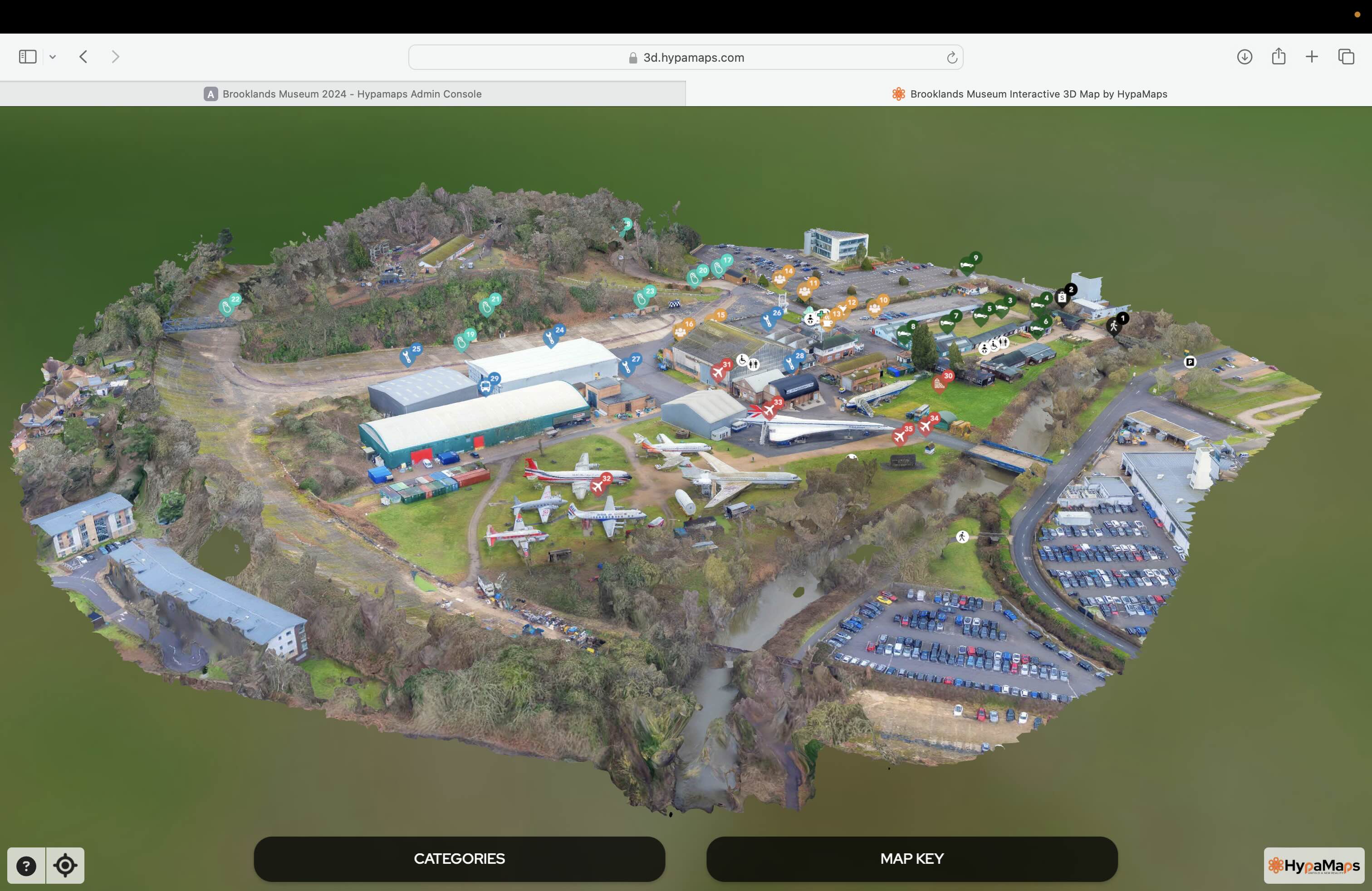
Interactive 3d Maps
Go to product
Service
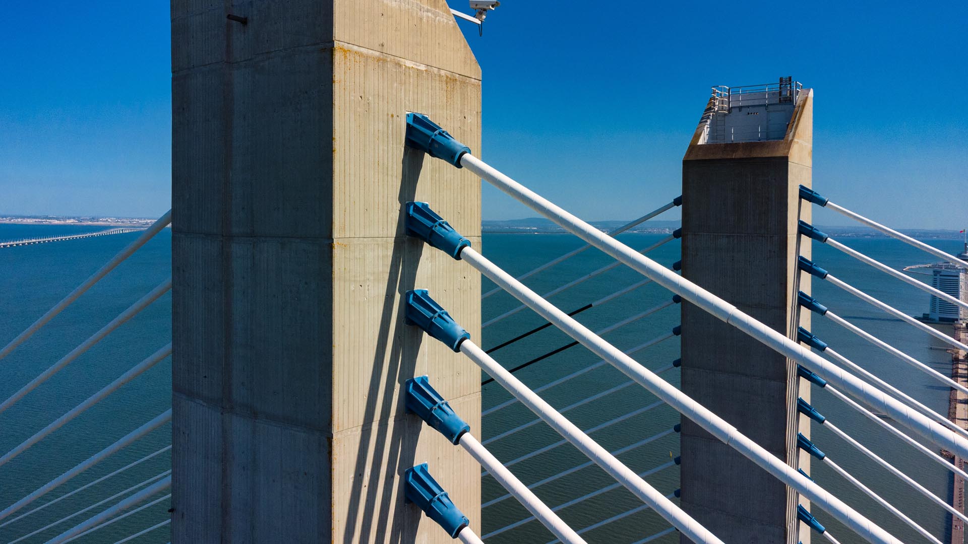
Aerial Drone Photography and Inspection
Go to product
A selection of suitable use cases for products or services provided by verified companies according to your search.
Use case
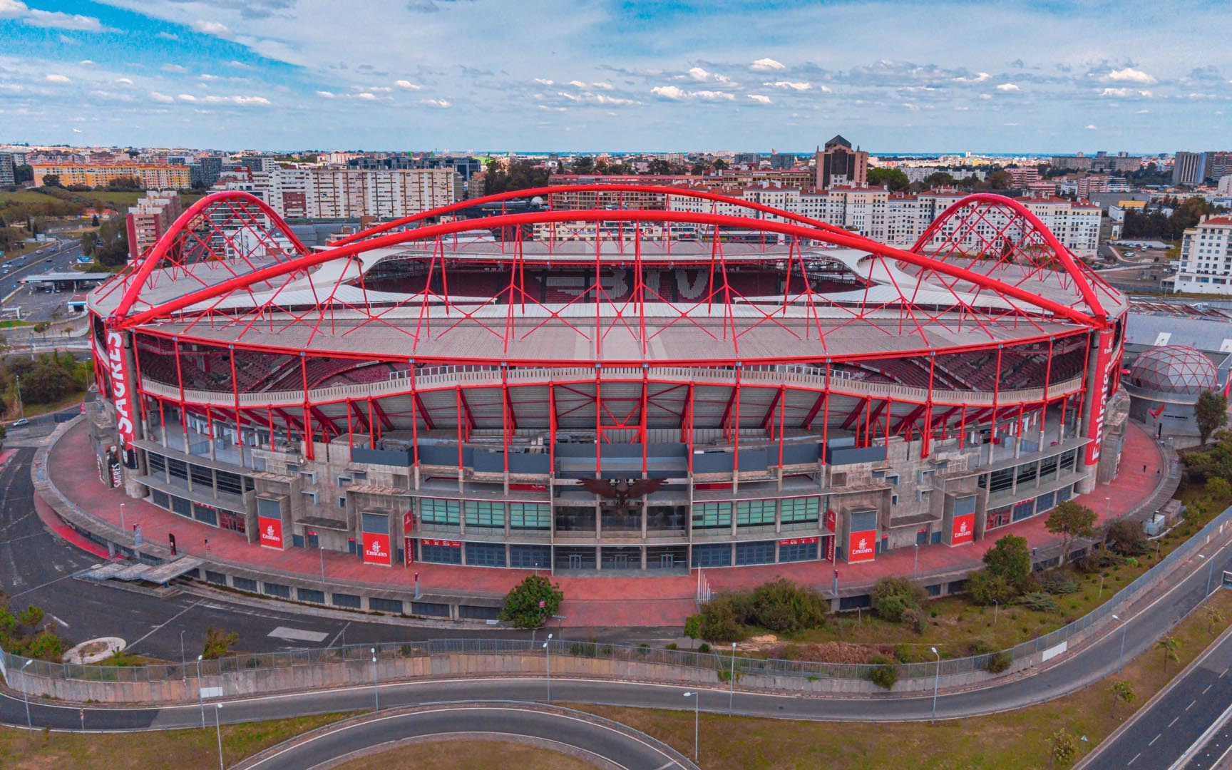
Aerial Video and Photography
Ortophotography, Aerial Mapping, Real Estate, Advertising, Marketing, Sports, Corporate Marketing, Construction
Serviços que podemos oferecer: Inspeções a estruturas e edifícios, telhados, instalações industriais, antenas de comunicação, cabos de alta tensão ou redes eléctricas suspensas. Mapeamento aéreo de terrenos, infraestruturas ou pontos de interesse. Ánalise detalhada de pequenas e grandes áreas com alto nível de resolução espacial. Captação de imagens aéreas para o sector dos transportes e mobilidade urbana. Estaleiros e infraestruturas navais, sistemas ferroviários e rodoviários. Imagens aéreas para o sector do turismo e hotelaria; hotéis, resorts turísticos, alojamentos locais, pontos de interesse turísticos ou eventos relacionados. Captação e cobertura de eventos relacionados com a arte e cultura; concertos ou festivais, arte urbana ou exposições interiores ou ao ar livre. Captação de imagens para eventos desportivos, promoção de eventos e associações desportivas ou infraestruturas relacionadas com o desporto.
Use case
Aerial Video and Photography
Ortophotography, Aerial Mapping, Real Estate, Advertising, Marketing, Sports, Corporate Marketing, Construction
Serviços que podemos oferecer: Inspeções a estruturas e edifícios, telhados, instalações industriais, antenas de comunicação, cabos de alta tensão ou redes eléctricas suspensas. Mapeamento aéreo de terrenos, infraestruturas ou pontos de interesse. Ánalise detalhada de pequenas e grandes áreas com alto nível de resolução espacial. Captação de imagens aéreas para o sector dos transportes e mobilidade urbana. Estaleiros e infraestruturas navais, sistemas ferroviários e rodoviários. Imagens aéreas para o sector do turismo e hotelaria; hotéis, resorts turísticos, alojamentos locais, pontos de interesse turísticos ou eventos relacionados. Captação e cobertura de eventos relacionados com a arte e cultura; concertos ou festivais, arte urbana ou exposições interiores ou ao ar livre. Captação de imagens para eventos desportivos, promoção de eventos e associações desportivas ou infraestruturas relacionadas com o desporto.
When exploring the Drone Mapping industry in Israel, several key considerations come into play. First, understanding the regulatory landscape is crucial, as the Israeli Civil Aviation Authority (ICAA) enforces strict guidelines on drone operations, including licensing, safety standards, and no-fly zones, especially in urban areas and near military installations. Challenges include navigating these regulations while also addressing technical issues such as data accuracy and integration with existing mapping technologies. The opportunities in this sector are substantial, given Israel's technological advancements and strong emphasis on innovation. The demand for drone mapping services spans various industries, including agriculture, construction, and environmental monitoring, making it a versatile field. Environmental concerns also play a role, as companies must consider the ecological impact of drone operations, particularly in sensitive areas. The competitive landscape is dynamic, with numerous startups and established firms vying for market share, often leveraging cutting-edge technology such as artificial intelligence for enhanced data analysis. Additionally, the global relevance of drone mapping is growing, as more countries recognize the efficiency and cost-effectiveness of aerial mapping solutions. Therefore, individuals interested in this industry should focus on regulatory compliance, technological capabilities, and market trends to make informed decisions when researching companies in Israel's Drone Mapping sector.
Some interesting numbers and facts about your company results for Drone Mapping
| Country with most fitting companies | Israel |
| Amount of fitting manufacturers | 102 |
| Amount of suitable service providers | 39 |
| Average amount of employees | 11-50 |
| Oldest suiting company | 2011 |
| Youngest suiting company | 2019 |
Some interesting questions that has been asked about the results you have just received for Drone Mapping
What are related technologies to Drone Mapping?
Based on our calculations related technologies to Drone Mapping are Big Data, E-Health, Retail Tech, Artificial Intelligence & Machine Learning, E-Commerce
Which industries are mostly working on Drone Mapping?
The most represented industries which are working in Drone Mapping are IT, Software and Services, Other, Aviation and Aerospace, Automation, Defense
How does ensun find these Drone Mapping Companies?
ensun uses an advanced search and ranking system capable of sifting through millions of companies and hundreds of millions of products and services to identify suitable matches. This is achieved by leveraging cutting-edge technologies, including Artificial Intelligence.