The B2B platform for the best purchasing descision. Identify and compare relevant B2B manufacturers, suppliers and retailers
Close
Filter
Result configuration
Continents
Select continent
Locations
Result types
Company type
Select company type
Industries
Select industry
Company status
Select company status preset
Number of employees
Min.
Max.
Founding year
UAVFORDRONE
Shenzhen, China
D
11-50 Employees
2013
Key takeaway
The company specializes in providing industrial drone solutions, including UAVs specifically designed for mapping and surveying. Their product range features multi-rotor and VTOL fixed-wing drones that can carry various payloads, such as cameras and sensors, tailored for different applications.
Reference
Core business
Industrial Drone Solution Provider & Manufacturer| UAVForDrone.com
Manufacturer for the industrial drone, UAV application on Mapping&Surveying, inspection, surveillance and air monitoring, Drone Payload and accessories.

ShenZhen Yuhang Smart Technology Co.,Ltd
Shenzhen, China
D
51-100 Employees
2016
Key takeaway
ShenZhen Yuhang Smart Technology Co., Ltd specializes in enterprise drones, including those designed for land photography mapping and surveying. They offer a range of high-quality drones, such as 3D lidar drones and those for industrial inspection.
Reference
Core business
ShenZhen Yuhang Smart Technology Co.,Ltd supply the enterprise drone
We are manufacturer that focus on land photography mapping surveying drone,Orthophoto and Oblique photography Drone.3D lidar drone,police Law enforcement drone.industrial inspection drone.
Geosys Hong Kong Ltd
Kowloon, China
D
11-50 Employees
2009
Key takeaway
GeoSys Hong Kong Limited specializes in UAV remote sensing technology, making it a key player in drone mapping solutions. They offer comprehensive services, including aerial data capture and processing specifically for mapping and structural inspection.
Reference
Core business
UAV Mapping – Geosys Solutions
Looking for more accurate results?
Find the right companies for free by entering your custom query!
25M+ companies
250M+ products
Free to use
Sky Drone
Hong Kong Island, China
D
1-10 Employees
2012
Key takeaway
Sky Drone develops advanced drone technology that enables unlimited connectivity through 4G and 5G networks, supporting HD video and real-time data transmission. Their solutions include autonomous drone systems and fleet management, which are essential for effective drone mapping operations.
Reference
Product
Solutions – Sky Drone
Autonomous Drone Solution ("Drone-in-a-Box") Drone-in-a-Box - Autonomous Drone Solution Fleet Management Solutions for UAV Vendors and Integrators global UAV connectivity via 4G / 5G / Satellite fleet management via secure web interface multi payload support payload data transmission (video streaming / still image) SDK
ComNav Technology
Huangpu District, China
D
251-500 Employees
2012
Key takeaway
ComNav Technology specializes in high-accuracy GNSS positioning solutions, which are crucial for unmanned systems, including drone mapping. Their commitment to providing efficient and economical solutions highlights their relevance in the drone mapping industry.
Reference
Product
Unmanned Aerial Mapping_ComNav Technology Ltd
Dimap HK Pty Limited
Kowloon, China
D
11-50 Employees
1998
Key takeaway
Dimap has over 25 years of experience in acquiring remote sensing data from various platforms, including UAVs, which is directly relevant to drone mapping. They offer a modular sensor design that combines Lidar, cameras, and hyperspectral scanners in a single flight, ensuring high-quality data collection tailored to clients' specific needs.
Reference
Service
Service - dimap
Dimap offers data collections based on fixwing aircrafts and helicopters under specific AOC regulations in the countries of operations and in accordance of ISO9001 and ISO14001. Due to the modular sensor design Dimap combines Lidar, Cameras and hyperspectral scanners as required by the client’s task in one flight and generates so complex and engineering quality
T-DRONES(DIY drone platform)
China
D
11-50 Employees
2016
Key takeaway
The company offers the T-Drones M1200, a UAV specifically designed for surveying and 3D mapping, with a payload capacity of 5kg. This highlights their expertise in drone technology and innovative solutions for various applications.
Reference
Product
T-Drones M1200 5kg Payload Uav for Surveying, 3D Mapping with Battery - China Drone Frame and Drone price
Certification: RoHS, CE Operating Radius: Remote Size: Small Usage: Multifunctions Structure: Unmanned Rotorcraft Transport Package: Carton
MicroMultiCopter Aero Technology Co
Shenzhen, China
D
11-50 Employees
2010
Key takeaway
Drones play a crucial role in hydraulic engineering by offering real-time mapping and data collection, which enhances efficiency and reduces costs.
Reference
Core business
MMC-UAV
LEADING MANUFACTURER OF INDUSTRIAL UAVS WITH 10 YEARS’ EXPERIENCE
Feiyan Remote Sensing
Nanjing City, China
D
251-500 Employees
2003
Key takeaway
Feiyan Aerial Remote Sensing Tech Co., Ltd. is a leading provider of advanced mapping technology, specializing in aerial data acquisitions and geospatial processing. Their expertise in drone photography, aerial photogrammetry, and LiDAR data acquisition positions them as a key player in delivering high-quality geographic insights for various industries.
Reference
Core business
about-Feiyan Remote Sensing
Beijing TT Aviation Technology Co. Ltd
Dongcheng District, China
D
51-100 Employees
2008
Key takeaway
Beijing TT Aviation Technology Co. Ltd (TTA) specializes in UAV applications, including drone mapping for various purposes such as land resource investigation, emergency rescue surveying, and military mapping. Their range of UAVs, equipped with advanced imaging systems and powerful control software, supports efficient and accurate mapping solutions.
Reference
Product
-Beijing TT Aviation Technology Co.Ltd
Technologies which have been searched by others and may be interesting for you:
A selection of suitable products and services provided by verified companies according to your search.

Service
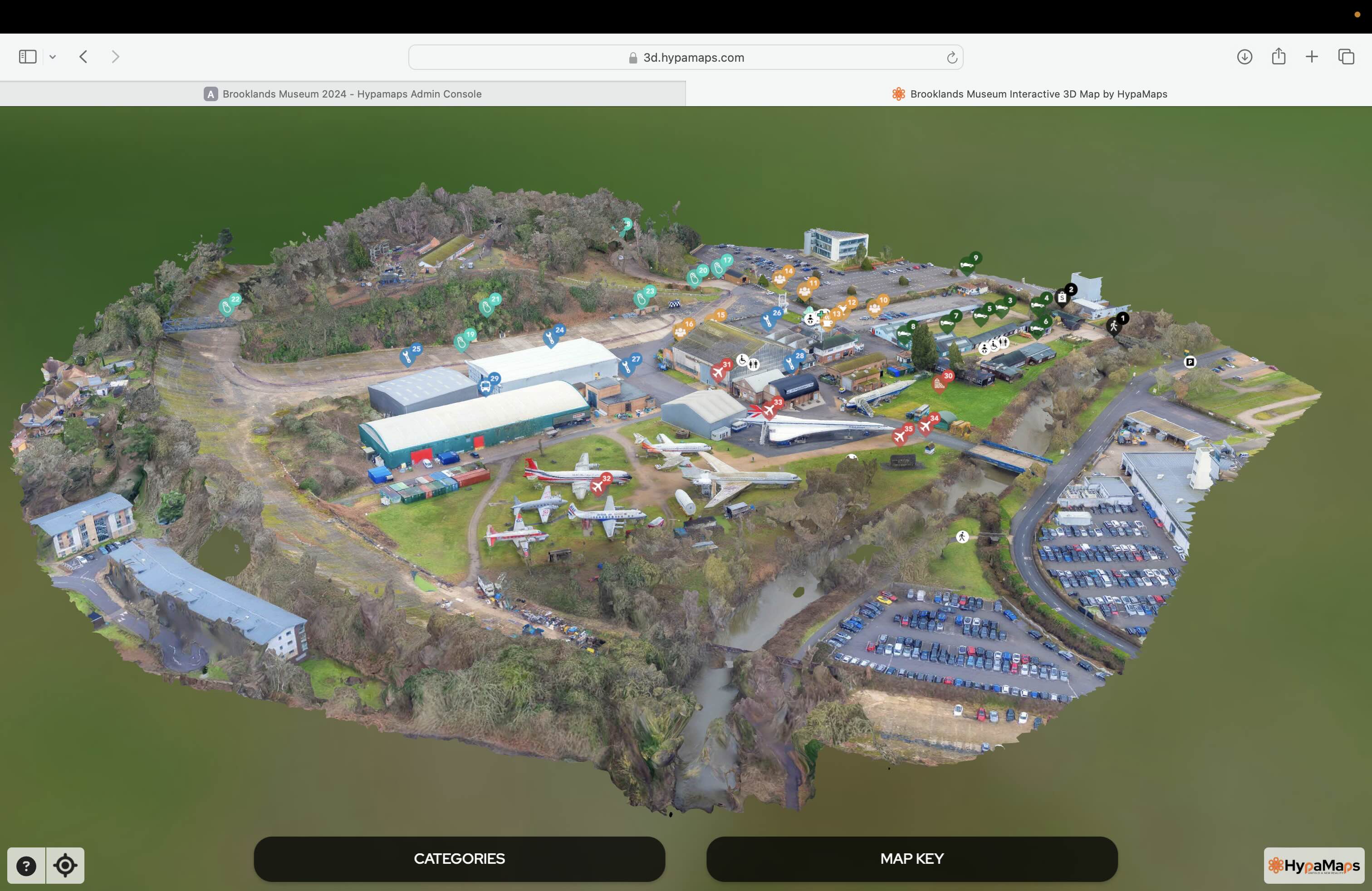
Interactive 3d Maps
Go to product

Service
Aerial Drone Photography and Inspection
Go to product
A selection of suitable use cases for products or services provided by verified companies according to your search.

Use case
Aerial Video and Photography
Ortophotography, Aerial Mapping, Real Estate, Advertising, Marketing, Sports, Corporate Marketing, Construction
Serviços que podemos oferecer: Inspeções a estruturas e edifícios, telhados, instalações industriais, antenas de comunicação, cabos de alta tensão ou redes eléctricas suspensas. Mapeamento aéreo de terrenos, infraestruturas ou pontos de interesse. Ánalise detalhada de pequenas e grandes áreas com alto nível de resolução espacial. Captação de imagens aéreas para o sector dos transportes e mobilidade urbana. Estaleiros e infraestruturas navais, sistemas ferroviários e rodoviários. Imagens aéreas para o sector do turismo e hotelaria; hotéis, resorts turísticos, alojamentos locais, pontos de interesse turísticos ou eventos relacionados. Captação e cobertura de eventos relacionados com a arte e cultura; concertos ou festivais, arte urbana ou exposições interiores ou ao ar livre. Captação de imagens para eventos desportivos, promoção de eventos e associações desportivas ou infraestruturas relacionadas com o desporto.
When exploring the Drone Mapping industry in China, several key considerations come into play. Regulatory frameworks are crucial, as the Chinese government imposes strict rules regarding drone operations, including registration, flight permissions, and no-fly zones. Understanding these regulations is essential for compliance and successful operations. Additionally, the competitive landscape is rapidly evolving, with numerous domestic and international companies vying for market share. This creates both opportunities and challenges, particularly in terms of innovation and pricing strategies. Another important factor is the technological advancements in drone mapping capabilities, including improved sensors and software for data processing. These advancements can significantly enhance the accuracy and efficiency of mapping projects. Environmental concerns also merit attention, as the industry faces scrutiny regarding the ecological impact of drone usage, particularly in sensitive areas. Moreover, China's burgeoning market for drone mapping solutions is fueled by sectors like agriculture, construction, and urban planning, which are increasingly adopting these technologies for precision and efficiency. Finally, global market relevance cannot be overlooked. China's position as a leader in drone manufacturing and technology means that developments in this sector can have far-reaching implications worldwide. Collaborating with local firms or understanding market trends will provide valuable insights for anyone looking to invest or engage in the Drone Mapping industry in China.
Some interesting numbers and facts about your company results for Drone Mapping
| Country with most fitting companies | China |
| Amount of fitting manufacturers | 91 |
| Amount of suitable service providers | 42 |
| Average amount of employees | 11-50 |
| Oldest suiting company | 1998 |
| Youngest suiting company | 2016 |
Some interesting questions that has been asked about the results you have just received for Drone Mapping
What are related technologies to Drone Mapping?
Based on our calculations related technologies to Drone Mapping are Big Data, E-Health, Retail Tech, Artificial Intelligence & Machine Learning, E-Commerce
Which industries are mostly working on Drone Mapping?
The most represented industries which are working in Drone Mapping are IT, Software and Services, Other, Aviation and Aerospace, Electronics and Electrical engineering, Automation
How does ensun find these Drone Mapping Companies?
ensun uses an advanced search and ranking system capable of sifting through millions of companies and hundreds of millions of products and services to identify suitable matches. This is achieved by leveraging cutting-edge technologies, including Artificial Intelligence.